
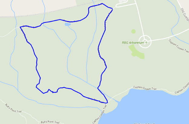
Captain Cootes Transect Loop map below
Captain Cootes Transect. Approx’ 2.1 Km. Starts at the parking circle in the Arboretum then just east of the Nature Centre it follows the Captain Cootes Trail down to the shoreline and then west to Hickory Creek. Turns inland and uphill via Hickory Valley Trail to the Magnolia display in the Arboretum, at the crest of the hill it turns east back to the parking circle. It’s better to do this route clockwise to keep the sun and its reflection off the water behind you as you walk along the water’s edge.
Cherry Hill Transect Loop map below
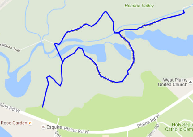
Cherry Hill Transect. Approx’ 2.6 Km. Starts at Cherry Hill gate. Follows Bridle Trail around two ponds with a detour along Creekside Trail as far as the footbridge and back.
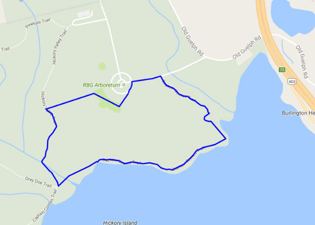
Grey Doe Transect Loop map below
Grey Doe Transect. Approx’ 2.5 Km. Starts at the Pinetum Trail in the top corner of RBG Arboretum. Follows Pinetum Trail west to the utility corridor then south along Grey Doe Trail to where it ends at Captain Cootes Trail. Loop returns inland and uphill via Hickory Valley Trail to follow the forested edge of the arboretum to the starting point. It’s okay to do this trail clockwise or counter-clockwise.
